
TRAVERSING TRAILS - A HIKING, BIKING & SCOOTER Guide
Sightseeing
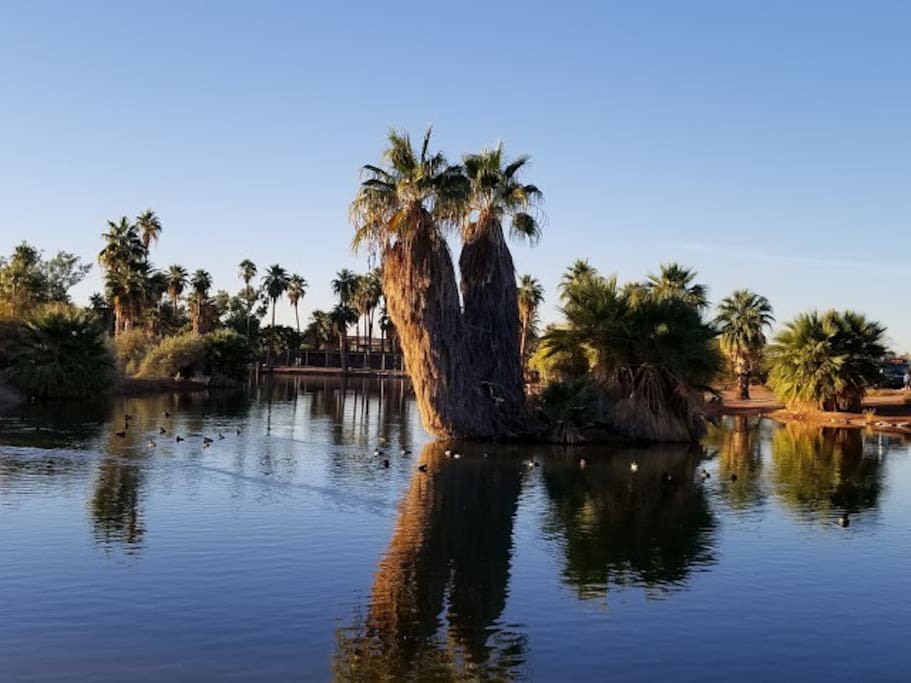
PAPAGO PARK is centrally located, bordered by Tempe, Phoenix and Scottsdale. There are more than 10 miles of trails that roll through the hills, perfect for hikers and mountain bikers. Trails are accessible from College Avenue and Curry Road and along Galvin Parkway near the Phoenix Zoo. Bike riders should also check out the Cross Cut Canal Path, a paved pathway lined with public art and scenic overlooks. The entrance is on the east side of Mill Avenue, just north of Curry Road.
543 polecane przez mieszkańców
Papago Park
625 N Galvin PkwyPAPAGO PARK is centrally located, bordered by Tempe, Phoenix and Scottsdale. There are more than 10 miles of trails that roll through the hills, perfect for hikers and mountain bikers. Trails are accessible from College Avenue and Curry Road and along Galvin Parkway near the Phoenix Zoo. Bike riders should also check out the Cross Cut Canal Path, a paved pathway lined with public art and scenic overlooks. The entrance is on the east side of Mill Avenue, just north of Curry Road.
“A” MOUNTAIN is one of the most popular hiking trails in Tempe. It is located in the middle of our downtown and is easily recognizable with the large gold “A” (for Arizona State University) on its south side. The hike to the top is quick, but steep towards the end of the trail. From its peak, you can see Tempe Town Lake, Downtown Tempe and the ASU campus. Access the trails from Third Street and Mill Avenue.
106 polecane przez mieszkańców
Tempe Butte
“A” MOUNTAIN is one of the most popular hiking trails in Tempe. It is located in the middle of our downtown and is easily recognizable with the large gold “A” (for Arizona State University) on its south side. The hike to the top is quick, but steep towards the end of the trail. From its peak, you can see Tempe Town Lake, Downtown Tempe and the ASU campus. Access the trails from Third Street and Mill Avenue.
SOUTH MOUNTAIN PARK AND PRESERVE is one of the largest municipal parks in the United States with more than 16,000 acres. There are 51 miles of horseback riding, hiking and mountain biking trails that navigate through this scenic desert environment. Choose from intense trails with steep inclines, or flat trails that allow a relaxing, close-up look at desert plants. The closest trailhead to Tempe is located off of 48th Street, just north of Guadalupe Road.
350 polecane przez mieszkańców
South Mountain Park
10919 South Central AvenueSOUTH MOUNTAIN PARK AND PRESERVE is one of the largest municipal parks in the United States with more than 16,000 acres. There are 51 miles of horseback riding, hiking and mountain biking trails that navigate through this scenic desert environment. Choose from intense trails with steep inclines, or flat trails that allow a relaxing, close-up look at desert plants. The closest trailhead to Tempe is located off of 48th Street, just north of Guadalupe Road.
CAMELBACK MOUNTAIN is one of the most iconic, and challenging, hiking destinations in the Phoenix area. The Echo Canyon Trail is located on McDonald Drive, near Tatum Boulevard. The Cholla Trail is located on Cholla Lane, a street south of McDonald Drive on the west side of Invergordon Road. Parking is limited.
1752 polecane przez mieszkańców
Echo Canyon Trail and Recreation Area
East McDonald DriveCAMELBACK MOUNTAIN is one of the most iconic, and challenging, hiking destinations in the Phoenix area. The Echo Canyon Trail is located on McDonald Drive, near Tatum Boulevard. The Cholla Trail is located on Cholla Lane, a street south of McDonald Drive on the west side of Invergordon Road. Parking is limited.
PIESTEWA PEAK in Phoenix is surrounded by Phoenix Mountains Park and Recreation Area and Dreamy Draw Recreation Area. The popular summit trail rises more than 1,100 feet. There are also dozens of hiking and biking trails around the mountain that are less strenuous, but equally beautiful. Trailheads are located off of Squaw Peak Drive, near Lincoln Drive/Glendale Avenue, just west of 24th Street, and at 32nd Street and Lincoln.
489 polecane przez mieszkańców
Piestewa Peak
PIESTEWA PEAK in Phoenix is surrounded by Phoenix Mountains Park and Recreation Area and Dreamy Draw Recreation Area. The popular summit trail rises more than 1,100 feet. There are also dozens of hiking and biking trails around the mountain that are less strenuous, but equally beautiful. Trailheads are located off of Squaw Peak Drive, near Lincoln Drive/Glendale Avenue, just west of 24th Street, and at 32nd Street and Lincoln.
Porady dla podróżnych
Przydatne zwroty
Bikes
In 2019, the League of American Bicyclists redesignated Tempe as a Gold-Level Bicycle-Friendly Community Award winner. Tempe provides safe bike facilities like the award-winning Western Canal Multi-use path and encourages residents to bike to work and for fun. Tempe has 215 miles of bikeways, including bike lanes, desert trails and canal pathsScooters and electric bikes are popular ways to get around town. Look for both in Downtown Tempe and near campus. Visit tempe.gov/bike for a comprehensive map of all of Tempe's bikeways and bike and scooter safety tips.
Zwyczaje i kultura
Bike rentals
The Bicycle Cellar - thebicyclecellar.com
Boat Rentals of America - Tempe Town Lake or Boat Rentals of America - Kiwanis Lake - boats4rent.com
Grid Bikes – look for the green bikes in stations throughout Phoenix, Mesa and Tempe, including Downtown Tempe, Arizona Mills and near the ASU Tempe Campus - gridbikes.com
Zarezerwuj, zanim wyruszysz
Experience the Sonoran Desert – Hiking and Biking
From a leisurely stroll along cactus-lined pathways to heart pumping mountain bike rides, you’ll find the right fit for your level of adventure. Here are a few of the most popular trails in and around Tempe.