
Great Smoky Mountains Guidebook
Hiking Trails with Waterfalls
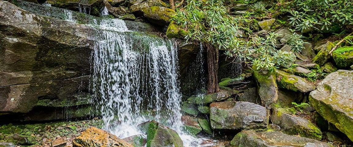
Grotto Falls is not only one of the most popular waterfalls, it’s one of the most popular hikes in the Great Smoky Mountains National Park! The waterfall itself is 25 feet high. What makes it special is that you can actually walk behind it. It’s also a popular spot for salamanders, and the cool environment around the falls makes it perfect for summer hikers.
111 polecane przez mieszkańców
Wodospad Grotto
Trillium Gap TrailGrotto Falls is not only one of the most popular waterfalls, it’s one of the most popular hikes in the Great Smoky Mountains National Park! The waterfall itself is 25 feet high. What makes it special is that you can actually walk behind it. It’s also a popular spot for salamanders, and the cool environment around the falls makes it perfect for summer hikers.
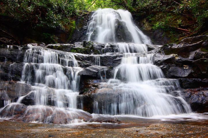
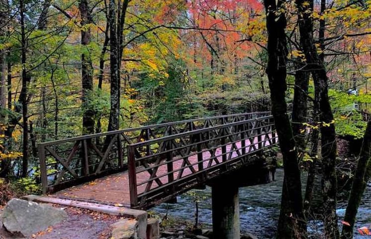
Laurel Falls is another one of the top waterfall hikes, and it’s a great hike for families to do! This 80-foot waterfall has both an upper and a lower section. There’s a walkway that stretches across the base of the upper falls, so you’ll almost feel like you’re walking right across the waterfall!
To get there: Hike Laurel Falls Trail for 1.3 miles. Mountain laurel, which is where the name of the waterfall comes from, can be seen along the trail and near the falls in May. The trail is paved, but keep in mind the pavement is rough and uneven. It takes about 2 hours to hike to the waterfall and back.
66 polecane przez mieszkańców
Laurel Falls
Laurel Falls is another one of the top waterfall hikes, and it’s a great hike for families to do! This 80-foot waterfall has both an upper and a lower section. There’s a walkway that stretches across the base of the upper falls, so you’ll almost feel like you’re walking right across the waterfall!
To get there: Hike Laurel Falls Trail for 1.3 miles. Mountain laurel, which is where the name of the waterfall comes from, can be seen along the trail and near the falls in May. The trail is paved, but keep in mind the pavement is rough and uneven. It takes about 2 hours to hike to the waterfall and back.
Abrams Falls is only 20 feet tall, but it’s still one of the most impressive Smoky Mountain waterfalls. The large volume of water rushing down the falls more than makes up for its lack of height. The water collects in a long, deep pool at its base, making for a breathtaking sight. Both the waterfall and the creek are named after a Cherokee chief whose village stood several miles downstream.
25 polecane przez mieszkańców
Abrams Falls
Abrams Falls is only 20 feet tall, but it’s still one of the most impressive Smoky Mountain waterfalls. The large volume of water rushing down the falls more than makes up for its lack of height. The water collects in a long, deep pool at its base, making for a breathtaking sight. Both the waterfall and the creek are named after a Cherokee chief whose village stood several miles downstream.
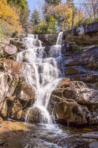
You don’t want to miss the chance to see Rainbow Falls when you visit the Smoky Mountains. This 80-foot waterfall is beautiful during any season! On sunny afternoons, you can see a rainbow produced by the mist of the falls. During extended cold weather, an impressive ice formation starts to build around the waterfall.
59 polecane przez mieszkańców
Rainbow Falls Trail
Rainbow Falls TrailYou don’t want to miss the chance to see Rainbow Falls when you visit the Smoky Mountains. This 80-foot waterfall is beautiful during any season! On sunny afternoons, you can see a rainbow produced by the mist of the falls. During extended cold weather, an impressive ice formation starts to build around the waterfall.
This 90-foot-high waterfall begins as a 2-foot-wide creek that fans down to a base that is 20 feet wide. If freezing temperatures are sustained long enough, the waterfall will freeze, forming a beautiful ice column. Hikers should plan on spending 3-4 hours on the moderately difficult trail. The roundtrip distance to the waterfall is 4.4 miles.
10 polecane przez mieszkańców
Hen Wallow Falls
This 90-foot-high waterfall begins as a 2-foot-wide creek that fans down to a base that is 20 feet wide. If freezing temperatures are sustained long enough, the waterfall will freeze, forming a beautiful ice column. Hikers should plan on spending 3-4 hours on the moderately difficult trail. The roundtrip distance to the waterfall is 4.4 miles.
The Laurel Falls Trail is a 2.6-mile roundtrip hike that’s considered moderate in difficulty. It is one of the most popular hikes in the Great Smoky Mountains National Park. The 80-foot waterfall has an upper and lower section that’s divided by a walkway that crosses the stream at the upper base of the falls.
133 polecane przez mieszkańców
Laurel Falls Trail
Laurel Falls TrailThe Laurel Falls Trail is a 2.6-mile roundtrip hike that’s considered moderate in difficulty. It is one of the most popular hikes in the Great Smoky Mountains National Park. The 80-foot waterfall has an upper and lower section that’s divided by a walkway that crosses the stream at the upper base of the falls.
Ramsey Cascades Trail is an 8-mile roundtrip hike that can be considered strenuous because it gains 2,000 feet in elevation on the 4-mile course to the waterfall, but every step is more than worth it. When you reach Ramsey Cascades, you will see the gorgeous sight of water dropping down 100 feet over rock outcroppings and collecting in a small pool below. It is the tallest waterfall in the park.
42 polecane przez mieszkańców
Ramsey Cascades Trail
Ramsey Cascades TrailRamsey Cascades Trail is an 8-mile roundtrip hike that can be considered strenuous because it gains 2,000 feet in elevation on the 4-mile course to the waterfall, but every step is more than worth it. When you reach Ramsey Cascades, you will see the gorgeous sight of water dropping down 100 feet over rock outcroppings and collecting in a small pool below. It is the tallest waterfall in the park.
Can’t-Miss Smoky Mountain Hiking Trails
The Alum Cave Trail has gorgeous view after gorgeous view. It is 2.5 miles one-way to the Alum Cave Bluffs. The Alum Cave Bluffs are about 80 feet in height and 500 feet in length. When it’s warm, water drips off the ledge above, and during the winter, the water droplets turn into icicles. Most people turn around once they reach the bluffs, but the trail continues for about 5 miles to the summit of Mount LeConte, the third highest peak in the Smoky Mountains.
56 polecane przez mieszkańców
Alum Cave Trail
Alum Cave TrailThe Alum Cave Trail has gorgeous view after gorgeous view. It is 2.5 miles one-way to the Alum Cave Bluffs. The Alum Cave Bluffs are about 80 feet in height and 500 feet in length. When it’s warm, water drips off the ledge above, and during the winter, the water droplets turn into icicles. Most people turn around once they reach the bluffs, but the trail continues for about 5 miles to the summit of Mount LeConte, the third highest peak in the Smoky Mountains.
The Porters Creek Trail is a 4-mile roundtrip hike that travels through a lush forest along the banks of Porters Creek. It is one of the most popular hikes during the spring because of all the gorgeous wildflowers. You will see historic sites and structures, as well as Fern Branch Falls, a 60-foot waterfall.
12 polecane przez mieszkańców
Porters Creek Trail
Porters Creek TrailThe Porters Creek Trail is a 4-mile roundtrip hike that travels through a lush forest along the banks of Porters Creek. It is one of the most popular hikes during the spring because of all the gorgeous wildflowers. You will see historic sites and structures, as well as Fern Branch Falls, a 60-foot waterfall.
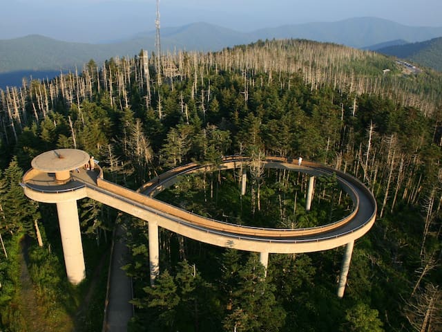
Clingmans Dome is the highest point in the Great Smoky Mountains National Park at 6,643 feet. It is a moderately difficult paved trail that leads to an observation tower, where you can see a breathtaking view of the Smoky Mountains. On clear days, views can span for over 100 miles. The trail to the observation tower is 1.2 miles out and back.
14 polecane przez mieszkańców
Clingmans Dome Drive
Clingmans Dome DriveClingmans Dome is the highest point in the Great Smoky Mountains National Park at 6,643 feet. It is a moderately difficult paved trail that leads to an observation tower, where you can see a breathtaking view of the Smoky Mountains. On clear days, views can span for over 100 miles. The trail to the observation tower is 1.2 miles out and back.
The Gatlinburg Trail is one of only two trails in the national park that allows dogs, so if your furry friend is with you in the Smokies, this is the perfect hike for you. It’s a 1.9-mile trail that travels from the Sugarlands Visitor Center to the outskirts of Gatlinburg. It offers views of the Little Pigeon River, as well as old homesites and foundations of chimneys.
19 polecane przez mieszkańców
Gatlinburg Trail
Gatlinburg TrailThe Gatlinburg Trail is one of only two trails in the national park that allows dogs, so if your furry friend is with you in the Smokies, this is the perfect hike for you. It’s a 1.9-mile trail that travels from the Sugarlands Visitor Center to the outskirts of Gatlinburg. It offers views of the Little Pigeon River, as well as old homesites and foundations of chimneys.
(3.3 miles round-trip) felt the brunt of the destruction caused by the 2016 wildfires, but it’s been mostly restored since reopening in fall 2017. This trail continues to be one of the most popular in the park year after year. It’s a great option for more experienced hikers, as it’s a pretty short, steep trail that offers incredible panoramic views at the top.
24 polecane przez mieszkańców
Chimney Tops Trail
(3.3 miles round-trip) felt the brunt of the destruction caused by the 2016 wildfires, but it’s been mostly restored since reopening in fall 2017. This trail continues to be one of the most popular in the park year after year. It’s a great option for more experienced hikers, as it’s a pretty short, steep trail that offers incredible panoramic views at the top.
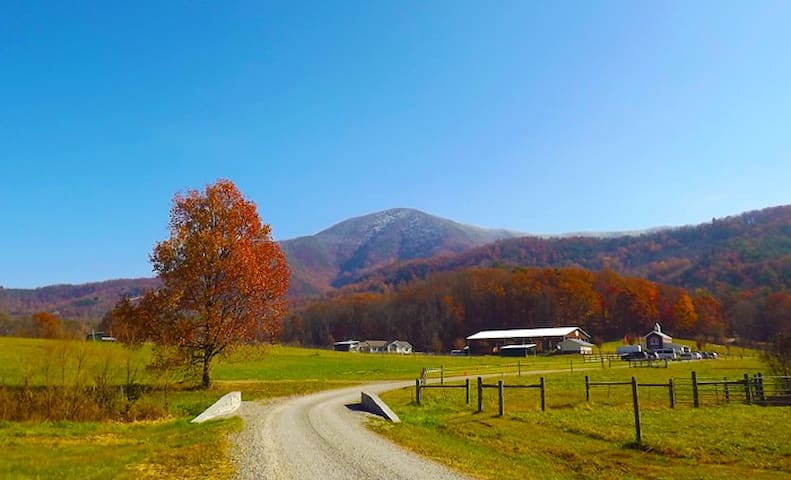
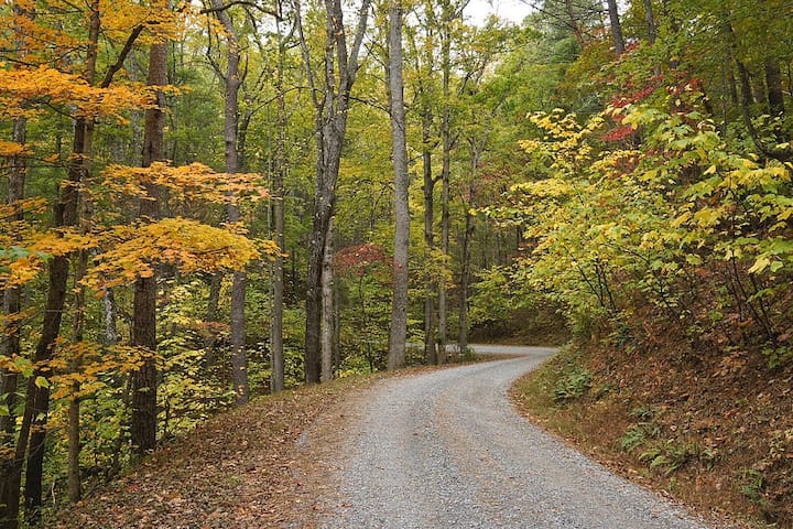
Popular Scenic Drives
The 11-mile loop road is a perfect drive when you’re looking to explore a little history and see the beautiful scenery in the Smokies. Many visitors would argue that Cades Cove is one of the most beautiful places to see in the Great Smoky Mountains National Park.
18 polecane przez mieszkańców
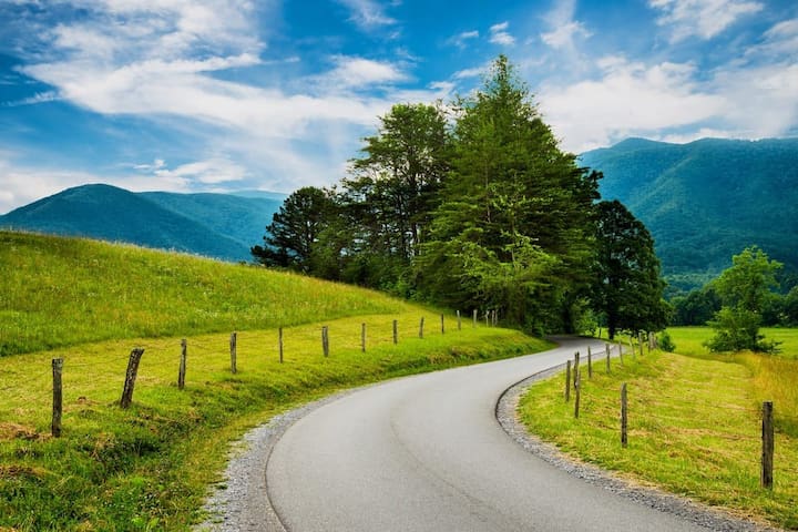
Cades Cove Loop Road
Cades Cove Loop RoadThe 11-mile loop road is a perfect drive when you’re looking to explore a little history and see the beautiful scenery in the Smokies. Many visitors would argue that Cades Cove is one of the most beautiful places to see in the Great Smoky Mountains National Park.
This 15-mile road takes you from Pigeon Forge to Townsend, showcasing the beautiful mountainside along the way.
Wears Valley Road
Wears Valley RoadThis 15-mile road takes you from Pigeon Forge to Townsend, showcasing the beautiful mountainside along the way.
Even though most people already know about Cades Cove, Rich Mountain Road is another peaceful route to take through the mountains. This is an 8 mile, one-way gravel road that offers stunning views of Cades Cove and leads back into Townsend. The entrance to this road is near the halfway point around the Cades Cove Loop Road, across from the Cove’s Missionary Baptist Church.
Rich Mountain Road
Rich Mountain RoadEven though most people already know about Cades Cove, Rich Mountain Road is another peaceful route to take through the mountains. This is an 8 mile, one-way gravel road that offers stunning views of Cades Cove and leads back into Townsend. The entrance to this road is near the halfway point around the Cades Cove Loop Road, across from the Cove’s Missionary Baptist Church.
This 5.5 mile, one-way, loop road is a great, short trip for many people who visit the Smoky Mountains. The narrow, winding road has a number of well-preserved structures like old cabins, grist mills and more. When you take a drive along this Smoky Mountain road, you’ll drive alongside the Roaring Fork stream which is absolutely stunning to see after a heavy rain!
192 polecane przez mieszkańców
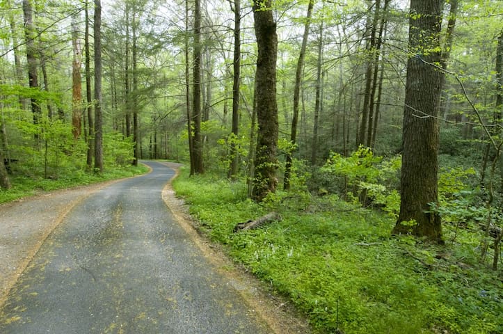
Roaring Fork Motor Nature Trail
Roaring Fork Motor Nature TrailThis 5.5 mile, one-way, loop road is a great, short trip for many people who visit the Smoky Mountains. The narrow, winding road has a number of well-preserved structures like old cabins, grist mills and more. When you take a drive along this Smoky Mountain road, you’ll drive alongside the Roaring Fork stream which is absolutely stunning to see after a heavy rain!
Kid-friendly hikes
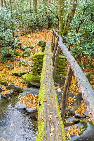
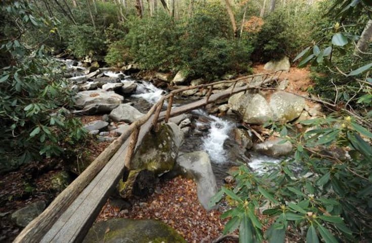
The Kephart Prong Trail offers your children a chance to explore Smokies' history from the logging era through the days of the Civilian Conservation Corps. This area was heavily logged prior to the establishment of the park, however forests have reclaimed the landscape since the days of logging. Keep on the lookout, though—you may still find evidence of the old logging railway.
This hike follows the Kephart Prong two miles to the trail shelter, with four log bridges crossing the creek along the path. The first two log bridges are easier to cross, however the last two log bridges are a little more challenging and may be appropriate for older kids who wish to see the shelter.
Kephart Prong Trail
Kephart Prong TrailThe Kephart Prong Trail offers your children a chance to explore Smokies' history from the logging era through the days of the Civilian Conservation Corps. This area was heavily logged prior to the establishment of the park, however forests have reclaimed the landscape since the days of logging. Keep on the lookout, though—you may still find evidence of the old logging railway.
This hike follows the Kephart Prong two miles to the trail shelter, with four log bridges crossing the creek along the path. The first two log bridges are easier to cross, however the last two log bridges are a little more challenging and may be appropriate for older kids who wish to see the shelter.
Porters Creek Trail is one of the many family-friendly hikes in Great Smoky Mountains National Park. Porters Flat is located in the Greenbrier Cove, 6 miles east of Gatlinburg. The 1 mile moderate walk from the parking lot to Porters Flat provides the opportunity to introduce kids to the natural communities within the cove hardwood forest. There are also historical remnants of the people who lived in the area before the park was established.
When you reach Porters Flat you will find a cantilevered barn, springhouse, and cabin. Children may imagine the daily routines of the 19th century as well as compare and contrast the lives of early settlers and people today. They will also witness how nature has reclaimed this area over the last 80 years. Spring is an especially good time to hike because of the spectacular wildflowers blooming from late March through April.
Distance: 2 mile round trip to Porters Flat from the parking lot
Trailhead: Greenbrier Cove, 6 miles east of Gatlinburg
Difficulty: Moderate
Restroom facilities: The closest restroom facilities are located at the Greenbrier picnic area, which you will pass on your way to the trailhead.
12 polecane przez mieszkańców
Porters Creek Trail
Porters Creek TrailPorters Creek Trail is one of the many family-friendly hikes in Great Smoky Mountains National Park. Porters Flat is located in the Greenbrier Cove, 6 miles east of Gatlinburg. The 1 mile moderate walk from the parking lot to Porters Flat provides the opportunity to introduce kids to the natural communities within the cove hardwood forest. There are also historical remnants of the people who lived in the area before the park was established.
When you reach Porters Flat you will find a cantilevered barn, springhouse, and cabin. Children may imagine the daily routines of the 19th century as well as compare and contrast the lives of early settlers and people today. They will also witness how nature has reclaimed this area over the last 80 years. Spring is an especially good time to hike because of the spectacular wildflowers blooming from late March through April.
Distance: 2 mile round trip to Porters Flat from the parking lot
Trailhead: Greenbrier Cove, 6 miles east of Gatlinburg
Difficulty: Moderate
Restroom facilities: The closest restroom facilities are located at the Greenbrier picnic area, which you will pass on your way to the trailhead.
Porady dla podróżnych
Zwyczaje i kultura
Picnicking
Picnic areas are located at Big Creek, Chimneys, Cades Cove, Collins Creek, Cosby, Deep Creek, Greenbrier, Heintooga, Look Rock, Metcalf Bottoms, and Twin Creeks. Download a park map to view the location of picnic areas in the park.
Picnic pavilions are available at Collins Creek, Cosby, Deep Creek,
Greenbrier, Metcalf Bottoms, and Twin Creeks, Pavilions can be reserved for groups one year in advance by calling (877)444-6777, or online at https://www.recreation.gov.
Zwyczaje i kultura
Fishing
Fishing is permitted year-round in the park, from 30 minutes before official sunrise to 30 minutes after official sunset. The park allows fishing in all streams.
You must possess a valid fishing license or permit from either Tennessee or North Carolina. Either state license is valid throughout the park and no trout stamp is required. Fishing licenses and permits are not available in the park, but may be purchased in nearby towns or online (links provided by state below). Special permits are required for fishing in Gatlinburg and Cherokee.
Nie przegap
Wildlife Viewing
Viewing wildlife in the Smokies can be challenging because most of the park is covered by dense forest. Open areas like Cataloochee and Cades Cove offer some of the best opportunities to see white-tailed deer, elk, black bear, raccoon, turkeys, woodchucks, and other animals. The narrow, winding road of Roaring Fork Motor Nature Trail encourages motorists to travel at a leisurely pace and sometimes yields sightings of bear and other wildlife. During winter wildlife is more visible because deciduous trees have lost their leaves.
Nie przegap
Synchronous firefly festival
This annual event, unique to the Smoky Mountains, should be on everyone’s bucket list. I’m embarrassed to admit that I’ve never been able to snag tickets to this extraordinary display of some of nature’s most unusual creatures, but that doesn’t stop me from attempting each year. This natural occurrence takes place in late May or early June in the Elkmont area of the park. As you can imagine, the popularity of this event means availability to attend in person is limited. Visitors who would like to view the fireflies in person must enter a lottery for a parking pass to take the shuttle from the